


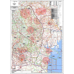
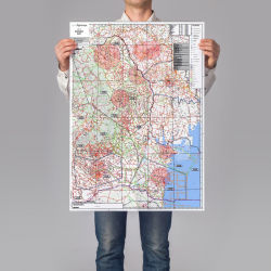
A printed flight chart for Romania - region East. Created and maintained by the OpenFlightMaps Association.
Contains terrain information, public and private airfields, airports, emergency landing sites, terrain information and all controlled areas. Useful for planning your flight or to learn about the VFR airspaces in Romania - Eastern Region.
This poster is part of the AERIAL Club collection. Buying this, your are not only buying a high quality product, but you also support the best private airfield and ultralight flight school in Romania. Are you already an ultralight pilot? You should definitely pay a visit, for stunning landscapes and to meet warm people.
 Everything is safe.
All orders are double-checked (by responsible people).
 You'll love it.
We're doing this since MANY years (and we didn't fail too many times).
 Safe payment & fast delivery
(but probably every seller is telling the same)

Data sheet